


onX Hunt: Offline Hunting Maps
4.522.47K Reviews
App Specs
- Version
- Varies with Device
- Updated On
- License
- Free
- Downloads
- 5,000,000+
- Developer
- onXmaps
- Categories
- Sports
- Platform
- Android, iOS
Screenshots
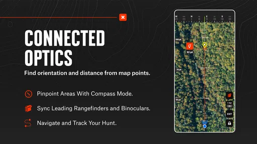
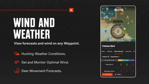
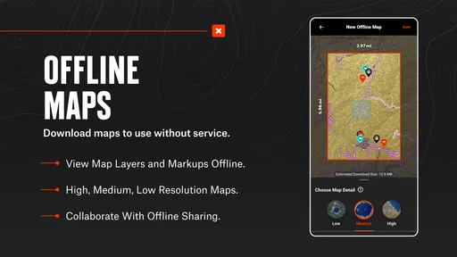
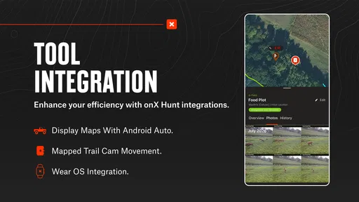
 Analysis by AppCompare
Before heading into unfamiliar country, I like to know what the map can answer and what still needs my own judgment. onX Hunt is a sports app from onXmaps built around hunting navigation: it combines terrain mapping, property boundaries, GPS positioning, and other map layers. It can be useful well beyond opening morning, from checking access while planning a trip to keeping track of a route once I’m outside reliable cell coverage. The key is to prepare before leaving home rather than expect a phone to solve every navigation problem on the fly.
What a first-time user should expect
This is more specialized than a standard road map or a general-purpose outdoor map. Its appeal is the way hunting-relevant information sits alongside terrain: I can consider where a boundary lies while also reading the shape of the land and planning how to approach an area. That combination is helpful, but it does not replace checking local rules, respecting posted signs, or using sound field judgment. A boundary shown on a screen is a planning aid, not permission to enter.
The app is free to install, and it has a 4.6 average from around 64,000 ratings. It has been installed over five million times and is rated for Everyone. Those figures suggest broad use, but they do not tell me whether its map coverage matches a particular hunting area; that is something I would check directly before relying on it. In-app purchases range from $9.99 to $99.99 per item, so I would review what is included and what a chosen purchase covers before committing.
There is a practical distinction between having a map open and having it ready for a remote outing. Offline use depends on preparing the area in advance: choose the place you expect to visit, save the relevant map material while connected, and make sure it is available on the device before you lose service. I would also open the saved map once before setting out. That quick check is more reassuring than discovering at a trailhead that I planned around the wrong patch of ground.
Set up around a real trip
My first setup would start with one specific destination rather than a large, vague region. I’d look at the terrain, identify the public and private boundaries that matter to my route, and save the map area I actually expect to use. This keeps preparation focused and makes it easier to notice if I have missed a turnoff, access point, or nearby boundary while reviewing the plan.
Then I’d mark a few useful reference points: the vehicle, a meeting place, or a point where the route changes direction. A waypoint is more valuable when its label explains why I saved it. “Meet here” or “check boundary” is easier to interpret later than a collection of unnamed pins. If I add notes, I’d keep them short enough to scan outdoors, when I may be wearing gloves or trying to keep my attention on the surroundings.
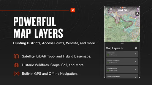
Map layers can help answer different questions, but switching them on without a purpose can make the screen harder to read. I’d begin with terrain and boundaries, then add only the layers relevant to the outing. For example, a wind layer may matter when deciding how to approach a spot, while a boundary layer matters when planning access. Treating layers as separate tools rather than turning on everything at once makes the map easier to interpret.
Worth Reading Before You Choose

EA SPORTS FC Mobile 26 Is a Bigger Football Game, but It Takes Time

Flipboard Shows What News Apps Must Do Beyond the Feed

Switching to Android Auto Means Rethinking Your Driving Routine

Google Calendar Makes a Crowded Week Easier to Manage

Ludo King Makes the Most of the Minutes Between Plans

Baby Panda World Brings Quick Play to Modern Phones, but Its Game Library Feels Busy
The first useful action in the field
A realistic first success is not finding game; it is reaching a planned landmark and confirming that the map, saved area, and your own position make sense together. At the trailhead, I’d check the route, note the vehicle location, and compare the terrain on screen with what I can see. If those match, I have a dependable starting point for navigating back or choosing the next leg.
GPS navigation can still be useful when mobile service is absent, but offline maps do not make a phone indestructible or remove the need to keep track of direction. I would conserve battery, keep the phone protected, and avoid treating a single screen as my only safety measure. A paper map or compass can still be a sensible backup on a serious trip, especially where weather, cold, or a low battery could make a phone inconvenient.
One helpful habit is to save a return point before walking away from the vehicle, then add a second waypoint only when it serves a clear purpose. That gives me a simple navigation thread without cluttering the map. On a group outing, sharing a location or route can also reduce confusion about where to meet, but everyone should agree on the plan rather than assume that sending a pin automatically gives the whole group the same context.
Where confusion can creep in
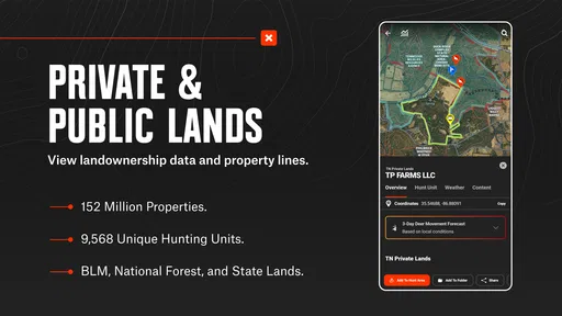
Property lines are among the most useful details for hunting plans, and also the ones I would treat most carefully. A digital boundary can help me spot a potential issue before I reach it, but it should not be the sole basis for deciding that a crossing is allowed. I’d check access arrangements and local requirements, look for signs on the ground, and turn around if the situation is unclear. The responsible choice matters more than making a route fit the screen.
It is also easy to confuse a saved map with a complete trip plan. A map helps with orientation; it does not decide whether a route is safe, open, or suitable for the day. Terrain that looks straightforward on a display can be demanding in person. I’d check conditions, estimate the outing realistically, tell someone where I’m going, and leave enough time to return. The app supports those decisions, but it cannot make them for me.
Another first-time question is whether to choose this over a general mapping app. If I mainly need driving directions, a familiar road-navigation app is simpler. If I want a broad outdoor map without hunting-specific boundary context, a general topographic option may be enough. onX Hunt makes more sense when land boundaries and hunting-oriented planning are central to the task. Its specialist focus is a strength for that job, not a reason for every outdoor user to switch.
Why onX Hunt is a Game Changer
Picture this: you’re deep in the woods, the sun is setting, and you need to find your way back to camp. With onX Hunt, you’ve got detailed maps right at your fingertips, even when you’re offline. Sounds like a dream, right?
The app is packed with features that cater to both seasoned hunters and those just dipping their toes into the hunting world. It offers detailed topographic maps that help you navigate terrain like a pro. And the best part? You don’t need cell service. You can download maps ahead of time and use them offline. It’s like having a trusty compass and a map, but way cooler.
User Experience: Easy Peasy Navigation
The interface is clean and intuitive—no rocket science here. You can easily switch between different map types to suit your needs, whether you’re tracking game or just exploring. I found the waypoint marking feature super handy. You can mark spots and add notes, so you never forget that perfect hunting spot.
Another sweet feature is the customizable layers. You can add layers for weather, wind direction, and even property boundaries. This is a lifesaver for ensuring you’re not accidentally wandering onto private land. It’s like having an all-knowing hunting partner right in your pocket.
Community and Sharing: Connect with Fellow Hunters
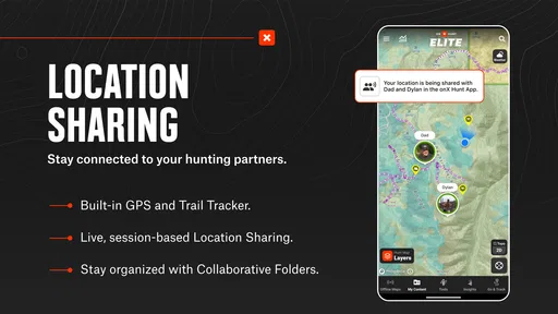
Ever wanted to brag about your hunting spot or share tips with friends? onX Hunt lets you do just that. You can easily share locations and routes with friends. It’s a great way to plan group hunts and share the experience.
The app also has a fantastic community vibe. You can connect with other hunters, share your experiences, and even pick up a few tips from the pros. It’s like having a hunting club right in your phone.
Learning to use the map without overrelying on it
For a newcomer, the best next step after saving a map is to practice with it somewhere familiar. I’d open the saved area, find a known landmark, and use the GPS display to understand how my position changes as I move. That low-pressure test makes the interface less distracting later, when I’m checking a route in unfamiliar terrain. It also helps me spot whether I’m looking at the right saved area before a trip becomes time-sensitive.
One trade-off with detailed mapping is that more information can invite more screen-checking. I try to decide in advance what I need the phone to answer: where am I relative to the vehicle, which way is the boundary, or where does the planned route turn? A quick check for one question is more useful than repeatedly zooming and panning without a decision in mind. The landscape still deserves my attention.
For a small group, I would agree on a shared meeting point and a simple fallback plan before separating. Location sharing can make coordination easier, but I would not assume every member has the same device, map setup, or service. The practical value is having a clear reference everyone understands, not relying on a feature as a substitute for communicating the plan.
Who will get the most from it
I’d recommend trying this app if you hunt in places where understanding terrain and land boundaries affects your route, or if you routinely plan trips before reaching areas with weak service. It is also useful for someone who wants to record a few meaningful locations and revisit them later, rather than relying on memory alone. A first-time hunter can benefit from the planning view, provided they take time to learn the map and verify access instead of assuming the screen answers every legal or safety question.
It is less compelling for someone who only needs turn-by-turn directions on paved roads, or who prefers not to manage saved maps and optional purchases. A casual walker who has no use for hunting-specific boundary context may be happier with a simpler navigation tool. Likewise, if you are uncomfortable making decisions from a phone in the field, a paper map and compass may be a better primary approach, with the app used only for advance planning.
The developer, onXmaps, has focused this product on outdoor hunting use rather than trying to make it an all-purpose navigation replacement. That focus is exactly why I would compare it with ordinary map apps by asking what I need to see, not which one has the most buttons. When property context and terrain planning are the deciding factors, a hunting map can save useful preparation time; when they are irrelevant, a general map is often enough.
My next-step routine before heading out
Before a real trip, I’d choose the area, inspect the route and boundaries, save the map while connected, and reopen it to make sure it is ready. I’d mark the vehicle and one or two purposeful reference points, then check that my phone has enough charge for the outing. Those steps turn installation into something practical without making the app itself the whole plan.
If I’m unsure what a paid option adds for my needs, I would compare the purchase details in the app before paying rather than assume every map or layer is included. The free starting point makes it possible to explore the interface, while the listed in-app items range from $9.99 to $99.99. That spread is a reason to match a purchase to a specific trip or use case, not to buy on impulse.
onX Hunt was released on November 8, 2013, and supports Android 8.0 and later. For someone choosing a mapping app today, its age is less important than whether it runs on their device and whether the areas they care about are useful in practice. I would test it in a familiar place first, then rely on it for a remote outing only after I’m comfortable with saved maps, waypoints, and the limits of phone navigation.
Final Thoughts: A Must-Have for Any Hunter
If you’re serious about hunting or just love exploring the outdoors, onX Hunt is a no-brainer. It’s user-friendly, packed with features, and works offline. Whether you’re tracking game, planning a trip, or just exploring, this app has got your back. I’ve found it to be an invaluable tool in my hunting adventures, and I’m sure you will too.
So, next time you’re heading out, make sure you’ve got onX Hunt loaded and ready. Happy hunting!
Pros
- Highly detailed offline maps available.
- Real-time GPS tracking and location sharing.
- Customizable map layers for hunting.
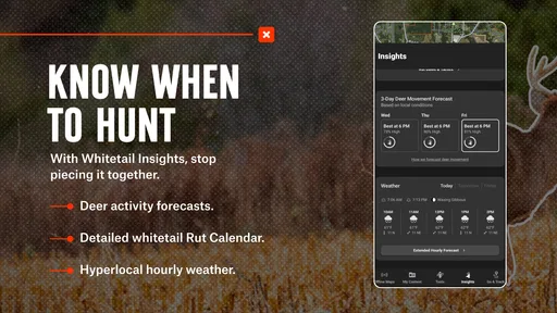
- Weather updates integrated into app.
- User-friendly interface with intuitive navigation.
Cons
- Premium features require subscription.
- Battery drain with prolonged GPS use.
- Limited to certain geographic areas.
- Occasional map loading delays.
- Requires initial internet for map download.
FAQs for onX Hunt: Offline Hunting Maps
What is onX Hunt, and how does it benefit hunters?
onX Hunt is a comprehensive mapping app designed specifically for hunters. It provides detailed offline maps, land ownership information, and GPS tracking to enhance your hunting experience. One of its key benefits is the ability to download maps for offline use, ensuring you have access to crucial data even in remote areas without cell service.
How accurate is the land ownership information in onX Hunt?
The land ownership data in onX Hunt is highly accurate and regularly updated. It provides detailed boundary lines and ownership details, including public and private lands. This ensures hunters can confidently navigate legal hunting areas and avoid trespassing, making it an invaluable tool for planning and executing hunts.
Can I use onX Hunt without an internet connection?
Yes, onX Hunt is designed for offline use, which is perfect for remote hunting locations. Users can download maps and data before heading out, allowing access to critical features such as GPS tracking and land boundaries without needing an internet connection. This ensures a seamless experience in the field.
What features does onX Hunt offer for GPS tracking and navigation?
onX Hunt offers robust GPS tracking features, including real-time location tracking, waypoint marking, and route planning. The app allows you to track your path, mark important locations like trails and hunting spots, and even share routes with fellow hunters. These features make navigation and planning much more efficient and reliable.
Is onX Hunt available for both Android and iOS devices?
Yes, onX Hunt is available for both Android and iOS platforms, ensuring a wide range of compatibility with most smartphones and tablets. This allows users to access all app features regardless of their device choice, providing flexibility and convenience to hunters who rely on different operating systems.


